A Coastal Flood Warning is in effect from 8pm Monday to 5am on Tuesday.
A Winter Storm Warning in effect from 12am Monday to 6am on Tuesday.
A Coastal Flood Advisory is in effect from 9am Monday to 5pm on Monday.
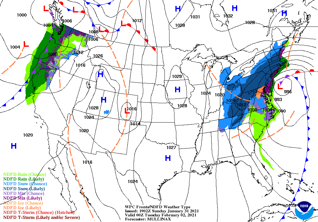
(East Farmingdale, NY) A slow moving but powerful nor’easter formed over the Atlantic early Monday morning and began to dump snow, whip winds and churn the seas around Long Island. WALK-FM Meteorologist Pat Pagano, “the storm will worsen throughout the day on Monday”. Winds are expected to ramp up as the afternoon continues, sustained 20-30 mph with gusts up to 40-50 mph. Blizzard conditions remain highly likely. All unnecessary travel should be avoided.
Monday night, Pat says there is a chance for rain and sleet mixing in for the South Shore of Nassau and Suffolk Counties as well as mixing possible, for the East End both North and South Forks, the mixing, could begin around 7-9pm and would continue into Tuesday morning. Pagano predicts that the North Shore of Nassau and Suffolk, will stay as snow overnight and the snow will continue to accumulate through Tuesday morning. A total of 10-15 inches of snow, with locally higher amounts is expected for most of Long Island. East End 4-8 inches of snow with locally higher amounts.
As for sleigh riding, Pat suggests Wednesday as the optimal day to take the kids out. Tuesday, the storm will still be around, with winds 20-25 miles per hour with a wind chill in the mid teens. Wednesday, it should be a little warmer than Tuesday, with temperatures in the upper 30’s, wind chills in the 20’s. Pat also says we could see more snow on Friday and again on Sunday.
Storm Totals
Islip: 10-15 inches of snow, with locally higher amounts.
Westhampton Beach: 4-8 inches of snow, with locally higher amounts.
Nassau/Queens line: 10-15 inches, with locally higher amounts.
High Tide Times
New Suffolk: 2:16pm 2/1/21, 2:53am 2/2/21, 3:06pm 2/3/21
Shinnecock Inlet: , 10:34pm 2/1/21, 10:51am 2/2/21
Moriches Inlet: 10:21p 2/1/21, 10:35a 2/2/21
Babylon: 12:19pm 2/1/21, 1:01a 2/2/21, 1:11pm 2/2/21
Montauk Harbor Entrance: 11:25am 2/1/21, 12:02am 2/2, 12:15 2/2/21
Port Jefferson: 1:54p 2/1/21, 2:23a 2/2/21, 2:45pm 2/2/21
Photo: National Weather Service/NOAA